Facilify.
Assisting users in finding and accessing public facilities effortlessly.
Project type: End-to-end app + branding.
Role: Sole UX/UI designer + brand designer, with support from my mentor.
Industry: Location-based services
Tools: Figma, FigJam, Illustrator
Duration: Dec 2023 - Jan 2024
Overview
In this project, the goal was to design and develop a Facility Locator App with a primary focus on creating an intuitive and user-friendly interface. The app aims to significantly enhance the user experience by providing a seamless solution for locating essential public facilities such as restrooms, diaper changing stations, elevators, and more.
The significance of the app lies in its mission to simplify and expedite the process of finding facilities, catering to diverse user needs. Whether it's aiding travelers, parents with toddlers, individuals with disabilities, or anyone in search of nearby amenities, the Facility Locator App strives to be a valuable and accessible tool for users in various scenarios. By offering a streamlined and efficient solution, the app aims to elevate the overall experience of navigating public spaces and facilities, making it a convenient and indispensable tool for users on the go.
Many users face challenges navigating to public facilities solely relying on signs or maps, resulting in inefficiency and frustration, particularly in crowded or unfamiliar environments.
Difficulty locating public facilities, especially for parents, travelers, and individuals with disabilities.
Existing navigation systems are not tailored to guiding users specifically to public facilities.
Problems
Implement a feature that provides users with real-time information about the availability of public facilities, allowing them to plan their visits more efficiently.
Enhanced Navigation System: Develop a navigation system tailored specifically to guide users to public facilities, offering optimized routes and clear directions within the app.
Encourage users to contribute reviews, ratings, and photos of public facilities, creating a community-driven database that enhances the app's reliability and usability.
Proposed Solutions
In a world where map apps are packed with features but lack accessibility for public facilities, finding what you need can be a challenge.
Research
My research focused on exploring various locations to gain insights into the challenges users encounter when seeking public facilities. Through interviews and surveys, I aimed to uncover pain points and gather valuable insights for designing a user-friendly app that simplifies the process of locating and accessing these facilities. Additionally, conducting one-on-one interviews allowed for a deeper understanding of user journeys and specific issues that the app should address.
Users, particularly parents with toddlers, travelers, and individuals with disabilities, often struggle to quickly locate nearby public facilities, especially when in unfamiliar areas or during travel.
Users express the need for a dedicated app that offers customized navigation, whether indoors or outdoors, to easily access desired public facilities. Current navigation systems often prioritize generic maps or directions, leaving users in search of a more tailored solution.
Participants express a preference for a simple and intuitive app interface that is easy to navigate and provides clear directions.
Users, especially those with specific needs, emphasize the importance of knowing the cleanliness and accessibility features of facilities. Reviews and ratings for these facilities would greatly assist users in making informed decisions about which ones to use.easy to navigate and provides clear directions.
Getting Closer to User-Centered Design
Defining Key Differences in Motivations Through Personas
As the research and design phases progressed, focusing on two key personas brought clarity to our goals. They served as essential reference points for developing functions that prioritize effortless facility location and easy navigation.
Understanding the user perspective, I created the personas to help us move forward with our decision-making.
Exploring Common Tasks in Order to Heighten User Empathy
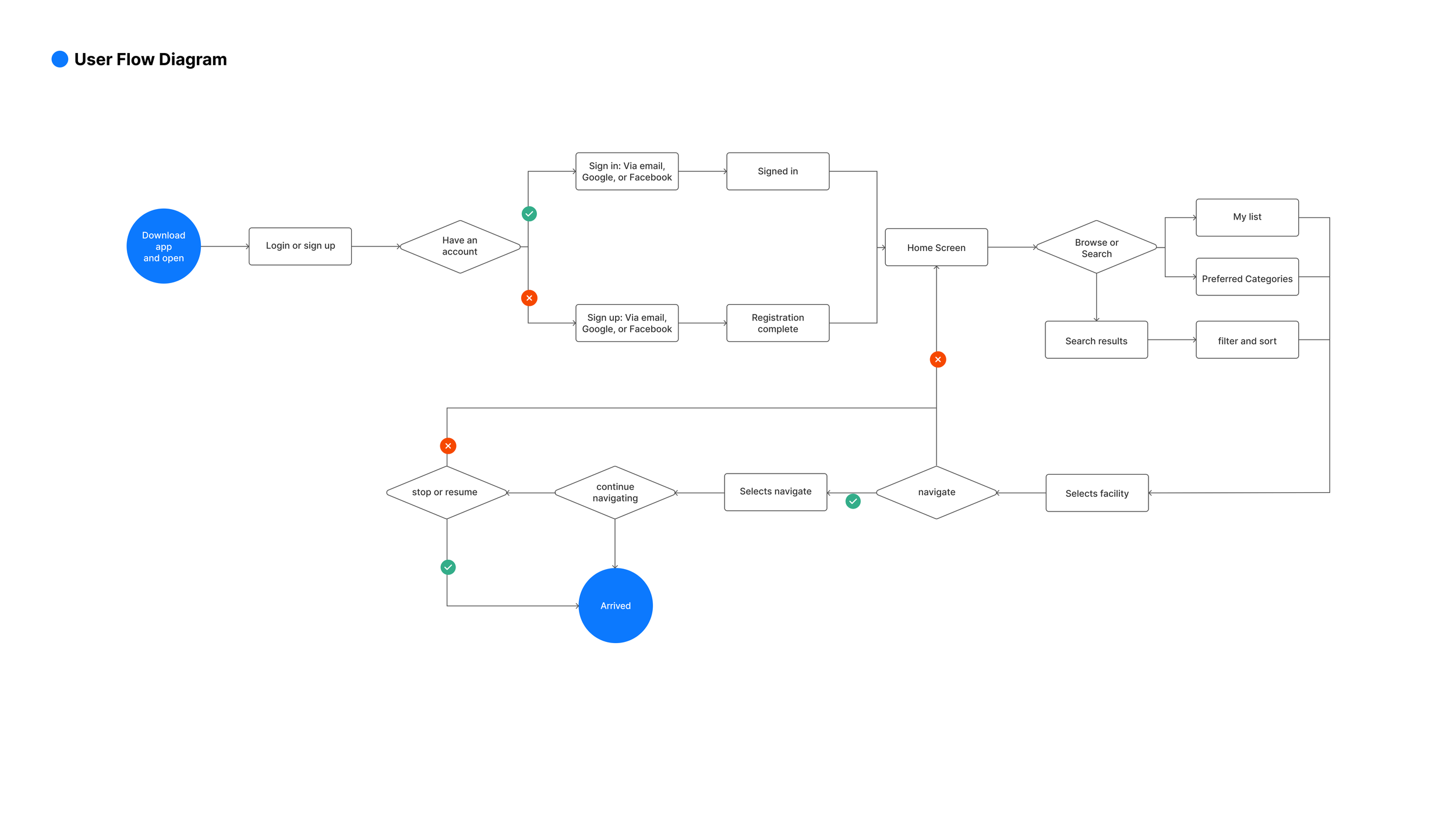
By delving into the journey maps of two personas tailored to Facilify, I identified crucial emotional and procedural moments. For instance, the frustration of not being able to find essential facilities easily. To ensure user engagement, the app must address these pain points without adding further complications.
Understanding What Users Find Intuitive, and Why
Low-fidelity prototype testing allowed me to better understand how users expected to complete the tasks I was focusing on. By studying their touch and swipe gestures — and more importantly, having a dialogue with them about what they expected and when — I knew which adjustments needed to be made to lay the foundation for a more fully realized high fidelity prototype. Small details such as actionable and consistent iconography, and consistent paths to get back, would become important elements of the design system.
High-Fidelity Prototype
How Usability Might Be Improved
Issues to Address for Longer-Term Development
Findings
Implement personalized recommendations based on user preferences and past interactions to streamline the facility discovery process and enhance user satisfaction.
Implement a more advanced interactive map such as 3D multi-floor navigation feature that allows users to visually explore nearby facilities with greater detail and customization options. An exploded view with all floors with arrows and progressive bar could make multiple floor direction a lot easier.
Introduce haptic feedback features to enhance the user experience, providing tactile cues and confirmation for interactions, such as finding and selecting facilities.
Enhance accessibility features to accommodate users with disabilities, ensuring that the app is fully usable and navigable for all individuals, regardless of their physical abilities.
Integrate augmented reality (AR) functionality to offer users immersive experiences when locating and accessing public facilities, providing real-time overlays of facility information in their surroundings.


